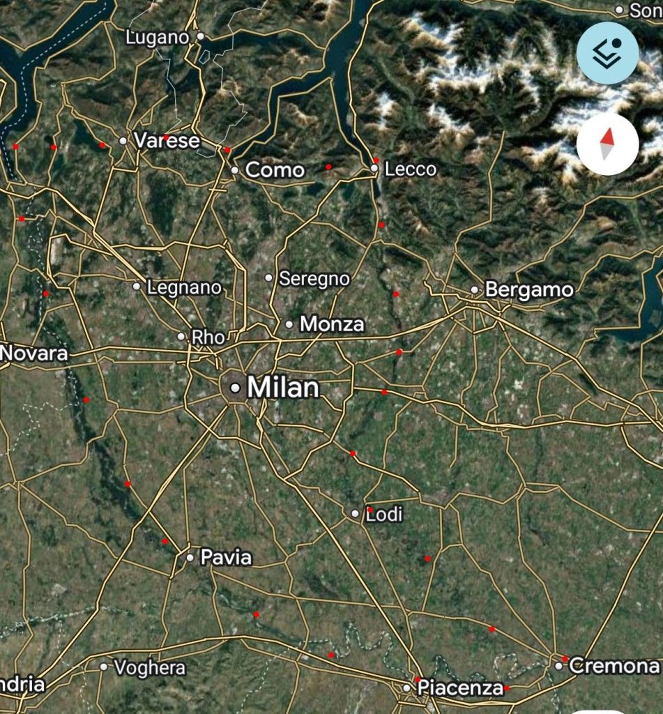
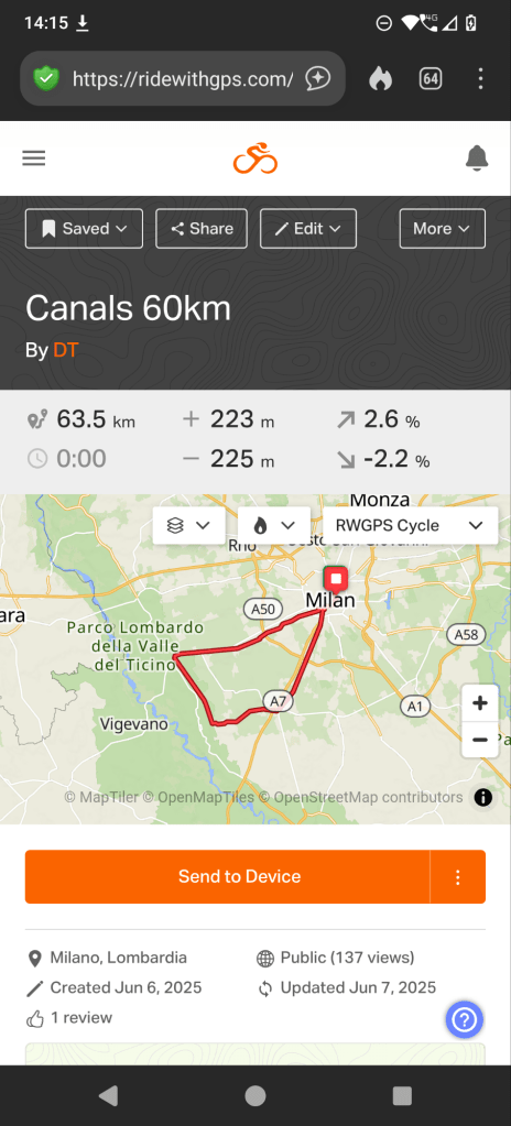
I love looking at maps of the world and imagining travel routes. One possibility that caught my eye decades ago is the “green triangle” around Milan:
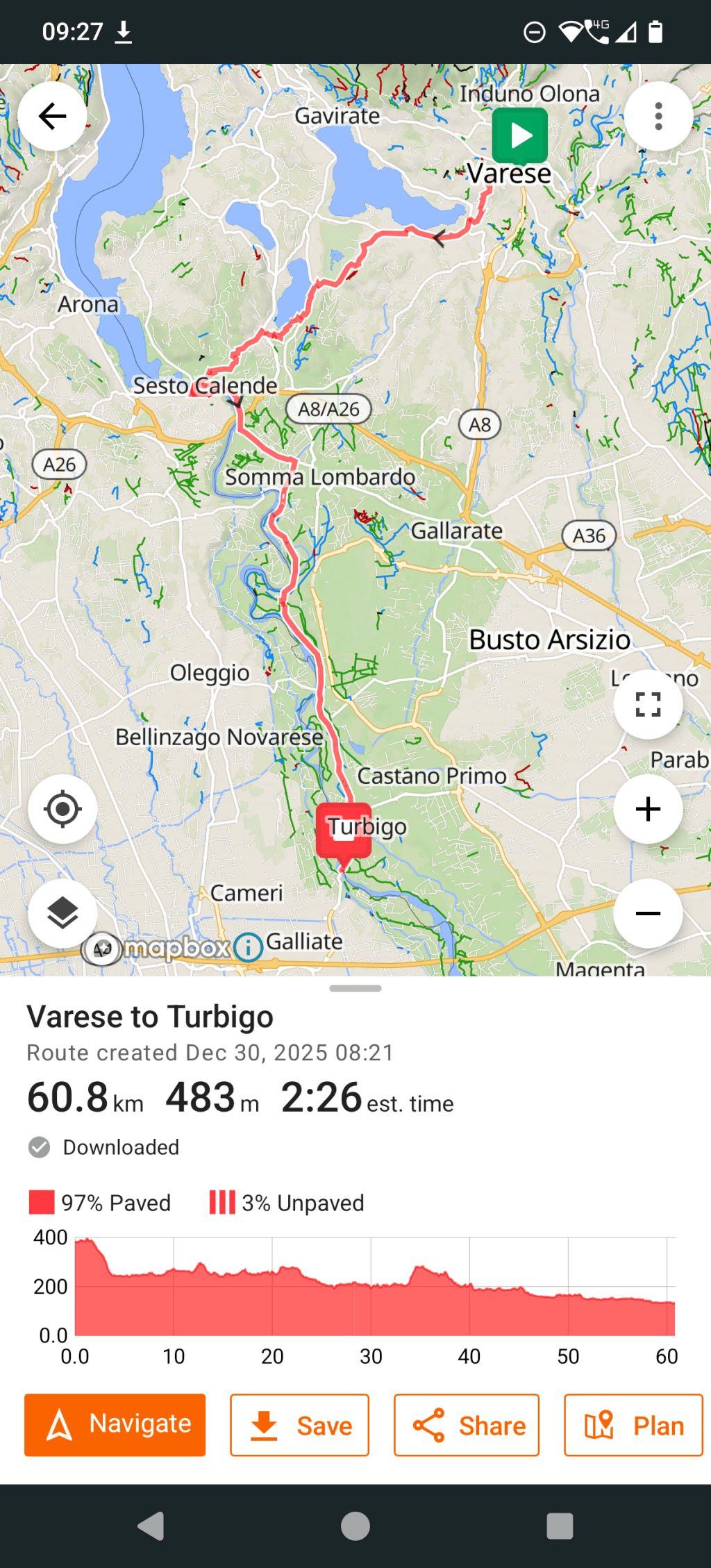
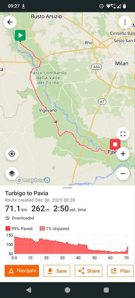
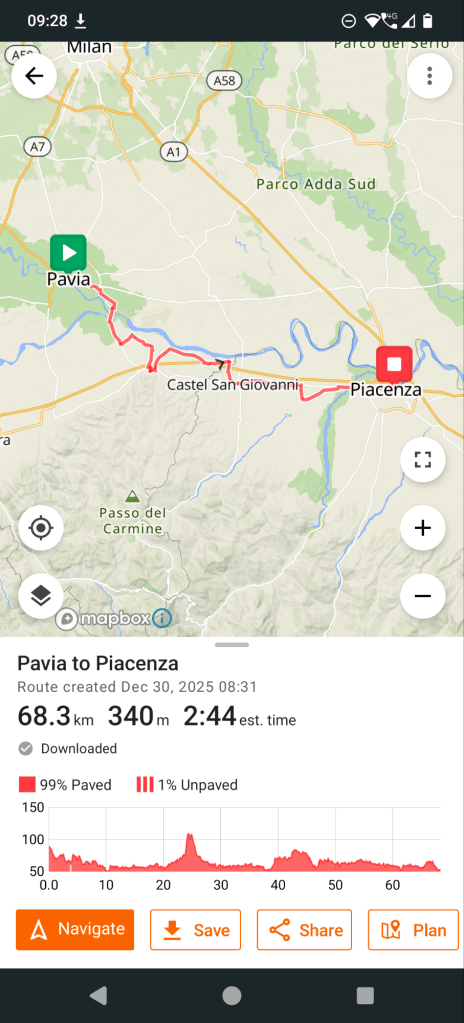
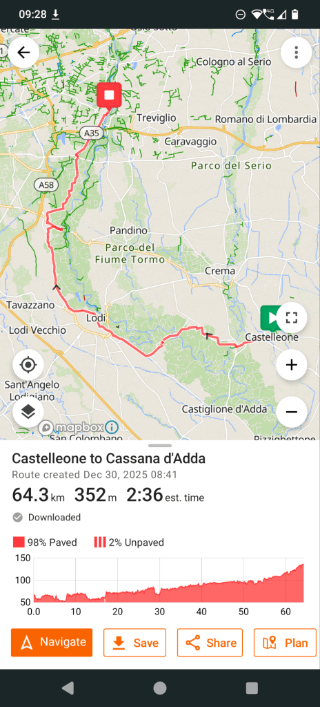
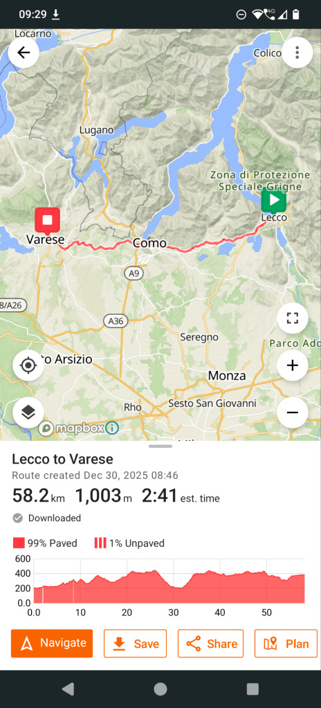
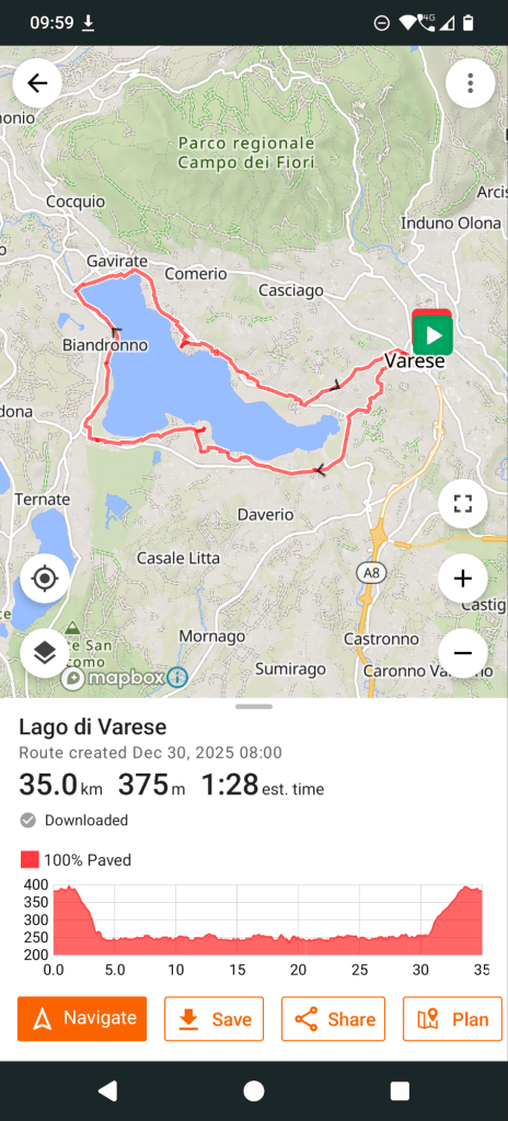
Since I have been pondering buying the Coros Dura Solar GPS Bike Computer, I thought I’d try to plan out this route using a bike route mapping app. I ended up using RideWithGPS and within 45 minutes I had a route mapped out. 7 days, between 50 and 80 kms a day, passing through towns such as Vigevano, which I’ve wanted to visit for a while. 2-3 hours of daily cycling gives me enough time to wander around the towns and not overextend myself, riding close to or in the green sections next to the rivers, on a road bike, mostly on paved roads.


I thought of doing this in April, the low season for mountain activities, and celebrate a year of not having a corporate job!
Open questions:
Should I pay the yearly subscription to RideWithGPS? What about Komoot? What about the Coros built-in planning capabilities? Or Bikemap?
A comparison that matches my impression: https://www.thenxrth.com/post/ride-with-gps-vs-komoot-which-is-better-for-bike-adventures
How much cycling am I going to do? A couple of hours a day for a few single and multi-day excursions? In the shoulder seasons?
Can I create one 7-day bike route, instead of 7 individual one? Is there an official cycling route down the Po? Yes, the EuroVelo 8 Route!
How does this approach transfer to planning amazing 2400m plus multiday backpacking trips? A dedicated cycling app obviously doesn’t but this calculated route planning strategy is very inspirational!
At least I can use my bikebackpack and visit some towns in northern Italy I’ve wanted to see, letting my brain ponder what I want to do in my second year of freedom.

Leave a comment